Crossing Islands
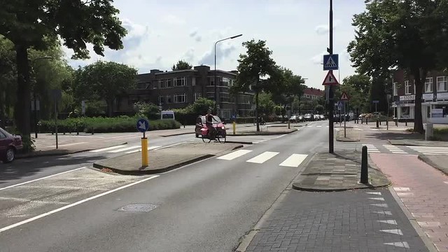
This web page examines crossing islands as a treatment to achieve sustainable safety. The map below shows the location of a crossing island located on Generaal Spoorlaan located in Rijswijk, NL.
Figure 1: Google Map of crossing island
Crossing islands or median refuges are areas for pedestrians and sometimes cyclists to wait in between opposing lanes of traffic. The islands allow pedestrians to cross one lane, wait in the middle until it is safe to cross and then cross the other lane of traffic. Figure 2 below shows a crossing island on Generaal Spoorlaan with a pedestrian waiting on the island. He has crossed one lane of motor vehicle traffic and is waiting on the island to cross another.
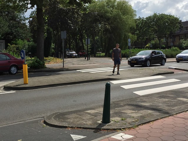
Figure 2: Pedestrian Crossing at Crossing Island
The main objective of this crossing island is to simplify the decision making process for the pedestrian as they are crossing the street. Pedestrians only need to look one way to cross to the island and then look the other way once they have reached the island. They do not have to look twice and double check before crossing. This concept of only having to focus on one lane at a time is especially important for children who are the most vulnerable users to cross the street. Children’s cognitive thinking and decision making capabilities are still developing and having to decide whether or not it is safe to cross is much easier when it is done in pieces.
This objective aligns with the sustainable safety concept of forgiveness of the environment and road users. Crossing islands limit the number of factors the user must take into consideration when deciding whether or not crossing the roadway is safe; thereby forgiving any human error or lapse in judgement. The crossing island markings such as the zebra stripes and the signage alert the automotive drivers that they are likely to encounter a pedestrian in this area, which aligns with the sustainable safety concept of recognition and predictability of road course and road user behavior.
On Generaal Spoorlaan, pedestrians and cyclists have to cross two one-way cycle tracks, two lanes of opposing motor vehicle traffic, and a right hand turn lane for cars exiting Generaal Spoorlaan onto Rembrandtkade. That means that pedestrians have five intersections with perpendicular traffic to think about when crossing the street. If there were a traditional zebra crossing at this location rather than a crossing island, users would have a lot of pavement to cross in one stretch. The crossing island allows resident on either side of the street easily cross a busy, distributor road.
This treatment effectively works to achieve its objective of simplifying the decision making process by limiting the number of lanes the user crosses at any given time, be it bicycle traffic or motor vehicle traffic. It works very well to minimize the possibility for human error. This is especially important due to the high volume of car and bus traffic that Generaal Spoorlaan sees every day.
The video below showcases an example of the use of the aforementioned crossing island along Generaal Spoorlan.