Healthy Gulf and Cartoscope have recently launched a new project, “Land Loss Lookout,” to give regular folks without access to boats or planes the opportunity to look over patterns of wetland loss in Louisiana’s Gulf Coast. This project is being co-led by SSEHRI’s Core Faculty member, Prof. Sara Wylie.
Anyone can join and contribute: Click the following link and give it a try today! http://cartosco.pe/landloss.
Follow the hashtag #landlosslookout and Healthy Gulf @healthygulf on Twitter to stay in the loop!
Background:
On Louisiana’s Gulf Coast, the Mississippi River Delta has grown into one of the most fertile landscapes in the world. Despite this economic and biological value, this delta has seen some of the largest ecosystem losses on record, including over 400 square miles of marshland lost to oil and gas activity (USGS Ofr 00-418). From New Orleans to Lake Charles, Louisiana is a much safer place from powerful storms of the Gulf with our wetlands than without (CPRA). In addition, now, faster than ever, the sea is rising, drowning even more land (CPRA).
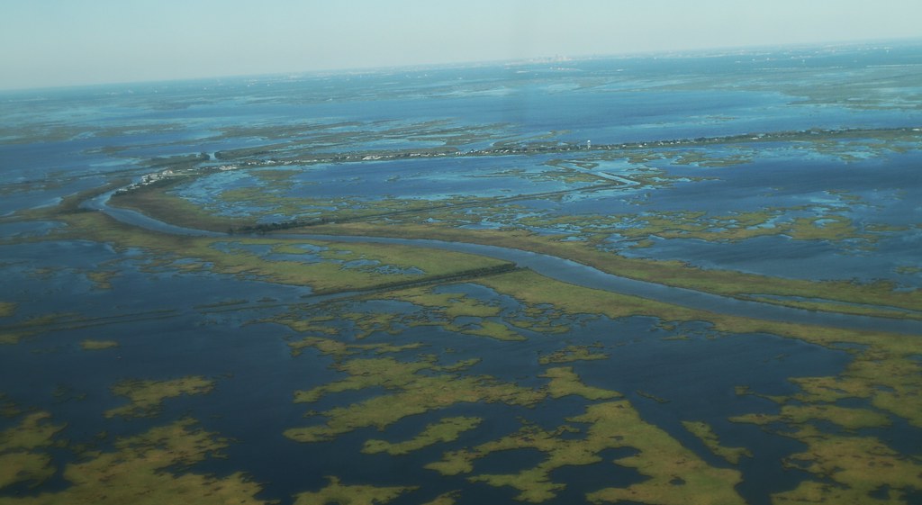
Companies like Chevron, Taylor Energy, and Venture Global LNG lobby the government to avoid the government accounting for their environmental impacts, and we need people power to counter their efforts. They have stated that there is no “proof” that sea level rise driven by their many megatons of carbon emissions is drowning wetlands. But we can see the drowning happening. When we fly over the wetlands, or look at google maps, a thousand small ponds speckle the marshlands, as lower-lying areas become too inundated to support plant life. This disintegration of land is happening in places invisible from our boats in the normal waterways, far from oilfields, and far from shipping canals we normally associate with wetlands loss. We call on you to witness this as well. Look at our coast with Land Loss Lookout, and tell us what patterns you see.
Infrared aerial photographs help us look at land loss on the coast. An infrared photograph turns the green and brown colors of marshlands into red. Water in an infrared photograph appears as dark blue or black. In Land Loss Lookout, you’ll be reviewing such infrared photographs and telling us what patterns you see.

A tutorial on the site will teach you how to identify one characteristic pattern of land loss. You’ll then be shown photographs and have a chance to indicate whether you can see that pattern in the photograph above.
Get started, and visit the website here! Or learn more on the Heathy Gulf webpage here.