In August 2020, our lab launched a study in collaboration with the City of Chelsea, MA to measure air quality in the downtown area. Due to the current lack of air quality monitoring stations in Chelsea, baseline information about air quality is sparse, making it difficult to evaluate air quality impacts of suggested changes in transportation policy or other infrastructure management. Therefore objective of the study is to better understand the exposure commuters in the city face and to evaluate the effects of transportation initiatives, such as the addition of a restricted bus lane along Broadway in Chelsea’s downtown area.
Study Design: Evaluating Restricted Bus Lane Effects on Pedestrian Air Quality Experience
This project, led by graduate student Alex Cabral, will have air quality monitoring equipment installed from approximately 4-6 weeks before the start of construction until approximately 12-14 months after completion of construction to capture air quality over a range of traffic, behavioral, and seasonal conditions. Air quality sensors are placed primarily adjacent to bus stops (see map below), with the goal of characterizing the air quality experienced by pedestrians in the downtown area.
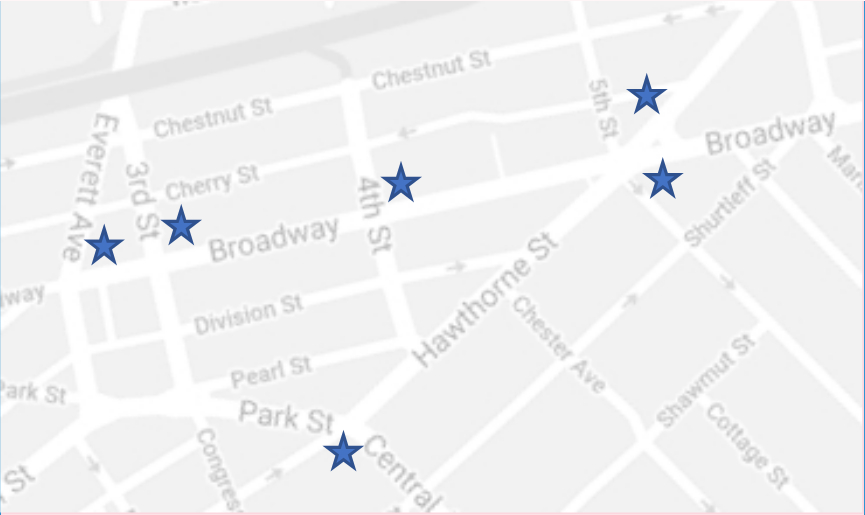
Study area in Chelsea, MA. Sensors deployed along Broadway (one way traffic flowing southwest) to study effects of restricted bus lane being added on this road. Sensors along Park and Hawthorne Streets will capture broader regional traffic pattern effects.
For this study we will compare (1) air quality before and after the bus lane is implemented (accounting for seasonal effects) and (2) at bus stops near the bus lane versus ones that are not (accounting for potential traffic pattern changes). This analysis will result in an evaluation of the impacts (if any) of the restricted bus lane on hyper-local air quality in Chelsea’s downtown.
This project focuses on measuring primarily particulate matter (small and course size fractions) and secondarily key gasses associated with fossil fuel combustion. Weather monitoring stations are also being installed in the study area so that the intermittent effects of wind and precipitation can be identified. We are using two different low-cost sensors: the Microsoft EcoLeaf and the PurpleAir PA-II.
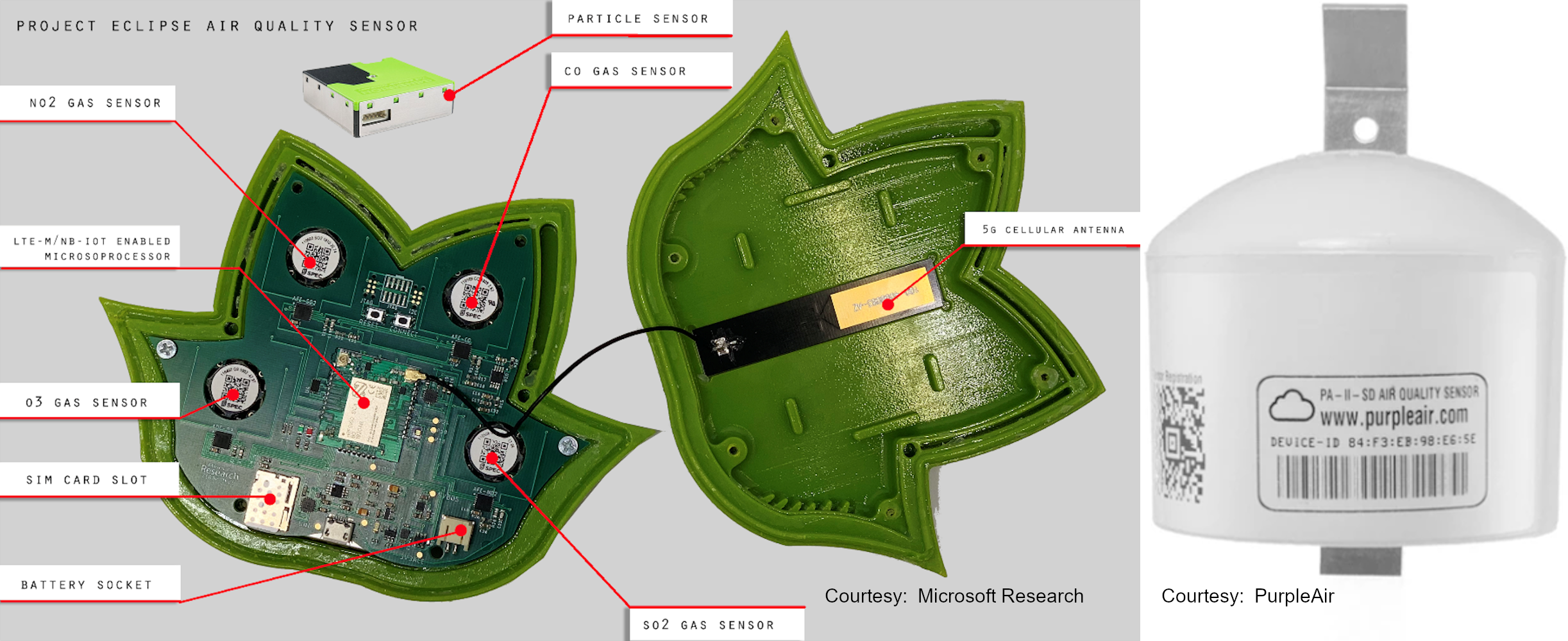 Air quality monitoring sensors used in this study
We are also conducting mobile monitoring (using several affordable Dylos DC1700 air quality monitors and a research grade TSI DustTrak DRX aerosol monitor 8533) to collect higher resolution data across the study area and to provide ground-truth measurements for field calibration of the installed air quality sensors.
As results become available, findings will be shared on this site and through academic publications as appropriate (weblinks will be added here).
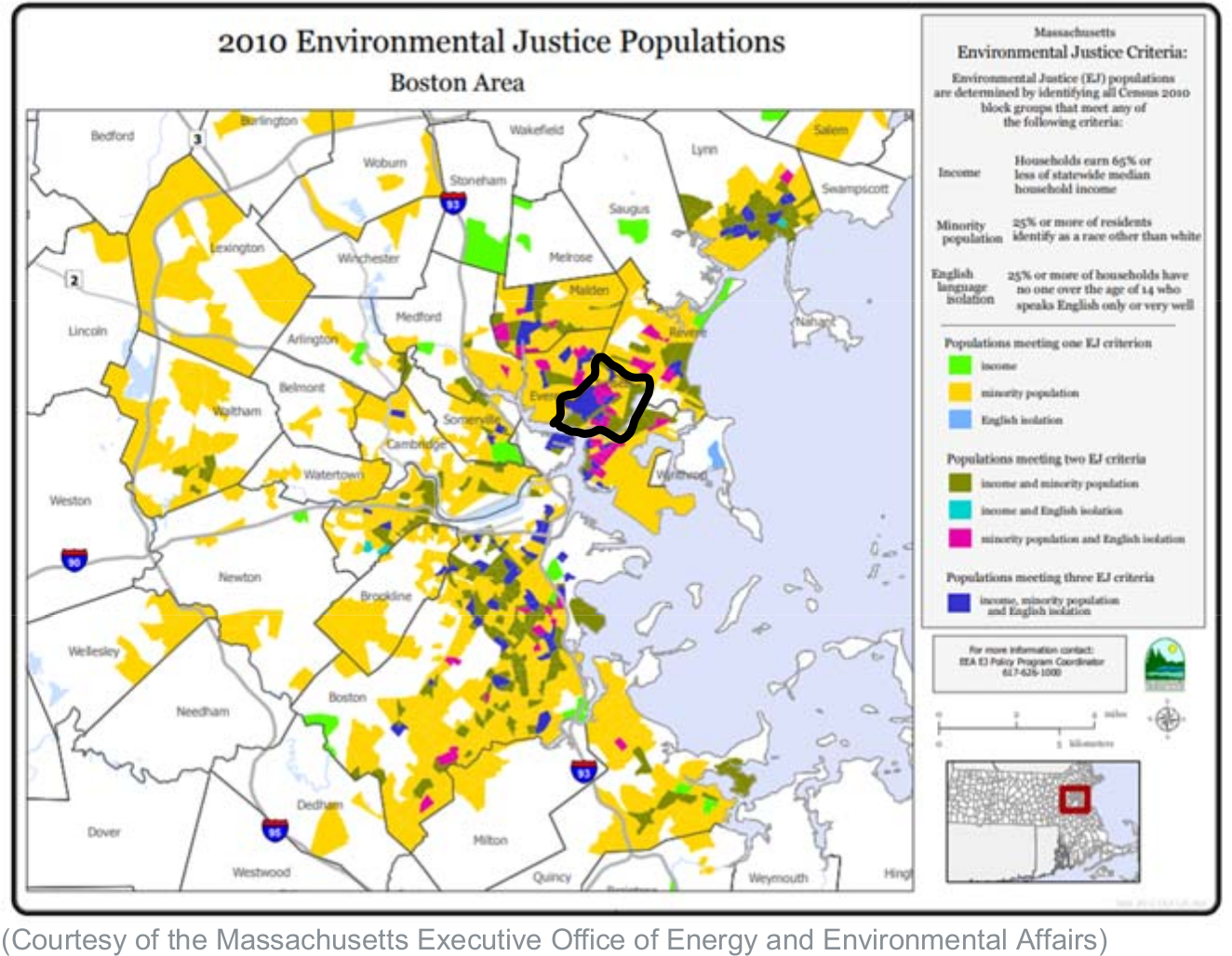
About Chelsea, MA
Chelsea (population approximately 40,000) is the second most densely populated municipality in Massachusetts and is located along the Mystic River immediately northeast of Boston (outlined in the map below). Because of the proximity to Logan International Airport, numerous highways, industrial facilities, and other emission sources, the residents of Chelsea, MA may be exposed to higher levels of particulate matter and air pollution than other cities in Massachusetts and the United States. In recognition of these challenges, Chelsea is designated as an Environmental Justice Community by the state of Massachusetts.